Hello.
The dutch track number signs can't show double digit track numbers or a number with a letter beacuse the textfeld polygon is too small.
Maybe ou could make the polygon a bit wider so it accepts two didgit numbers.


Hello.
The dutch track number signs can't show double digit track numbers or a number with a letter beacuse the textfeld polygon is too small.
Maybe ou could make the polygon a bit wider so it accepts two didgit numbers.

Gerade bei Häusern würde ich doch lieber auf dds setzen. Die Qualitätsverluste sind da normalerweise nicht so bemerkbar und man spart einiges an Speicher. Das Format bei den bereits gebauten Häusern zu ändern ist vom Aufwand her auch nicht die Welt.
Welches Programm ist deiner Meinung nach dafür geeignet? Mein Corel PaintShop Pro x7 kann keine dds. Datein erstellen.
Fur adobe photoshop und nach meines wissen auch paintshop pro ist in plugin verfugbar bei nVidea. suche nvidea texture tools. Das lauft bei mir perfect in adobe photoshop.
Zum download fur die neuste version brauche sie ein gratis developer acccount bei nvidea.
Die stand alone texture tools soll auch dds speichern können.
Nice dahsboard. Maybe also add some stracthes around the keyhole? It looks a bit weird with quite extensive damage around the door button but the rest being like brand new.
Naja. Die letzte link funktieniert ohne probleme:
Haben sie die richtige einstellungen.
Auch wichtig. Maximale bereich der photo
Die WMTS data sind nutzbar, das soll kein utm sein. UTM is nur bei WMS service notwendig.
Lotus braucht fur WMTS die Webmercator projection, EPSG:3587 (google genannt in ihr links)
Probiere diese URL fur luft bilder 2019:
Eingeben in alte methode (nicht utm) mit jpeg naturlich.
The polygon texture yo can easily make less shiny in map editor to match the spline. ![]()
Und hier: Luftbilder München via WMS server Geoportal Hilfe ?
Da ist diskutiert wie sie WMS server (und WMTS) auch nutzen kann. Meistens EU staaten (und deutsche bunderlander) haben offentlichen höhe auflösung bilder zu verfugen gestell. Mit ein frei nutzbares lizenz. (google, bing usw sind nicht immer frei nutzbar.)
 Alles anzeigen
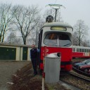
Erste Testfahrt von Joe auf der Bornholmer Str. Richtung Schönhauser Allee.
So langsam nimmt sie Gestallt an, hier und da werden Sachen bestimmt noch verbessert.
Bild stammt auch von ihm, und ich poste das einfach mal..
Berlin Linie 50 WIP
KT4Dtm
I really like both your grass textures, but somehting is weird with the screen.
A second look made me get it. In real you will probably never see that large of a difference between to grass areas next to each other. On is lush and green and the other is more yellowish.
Maybe you should use one of the two or merge/change htem to more have the same style/colour.
Just another little thought.
Could it be lotus is using a different ellipsoid then GRS 1980
If lotus is using WGS ellipsoid like with the old style url, it could be this UTM https://epsg.io/32631 and derivatives.
I've notice the flanders WMS service has this included. Don't know if anybody is able to test. (else i try this evening)
https://geoservices.informatie…0&request=GetCapabilities
It allows a lot of projections, might also be a nice test wms.
Thanks for some further explanation Rotbart .
Doubt th ebounding box is the issue. It could also be lotus somwhere internally rounding a calculation/transformation, causing this very slight offset. Maybe marcel can indded show some ligth on this.
I also did some more fiddling around and finally I tried to use the WMTS server, which works with the old style for aerial/maps.
Works a lot easier and loads a lot faster. guessed it needed to be EPSG:3857 (what google and OSM also use) and it shows nicely in lotus.
So now I'm using this url:
Don't now if german goverments offers wmts also.
I find this one for NRW: (which boundingbox goes from about Hannover-Fulda upto belgian/dutch border.
https://www.wmts.nrw.de/geobas….0.0/WMTSCapabilities.xml
Should be this url for use in lotus (or omsi) untested, but should work with png
Edit:
Have a look at the website of PDOK. There you can find all kinds of maps and orhto links for the netherlands. Most in WMTS and WMS.
The above link you can use for orthophoto. others on PDOK which could be usefull are TOP10 and TOP25 charts and the Opentopo chart.
I could be wrong, but i can see 28531 and 32 are listed in the list of available projection, there is just no boundingbox set, which is optional.
also afaik if it would use/default to 28992, lotus would show noting, because the coordinate values are way different then utm.
The ortho also lines up oke with default OSM, just some misaligned tilling here and there.
Looking at the link and screenshot of ACMG, that is a 28532 100% certain, because th eserver only suplies that projection. And he has a identical misalignment.
Tried both EPSG 25832 and 28531, which gave the same result regarding that edge, but seeing other have similair issue it might be a lotus thing.
It's not happening at all tile borders, only certain ones.
Well the wms capabilities are easily found here, so: https://geodata.nationaalgeore…0&request=GetCapabilities
I've got the same issue at tile borders.
Using public dutch 25cm ortho, with following WMS url:
Same happens with EPSG:25831 and meridan 3.
The online viewer has no issue at this edge:
Which EPSG projections does lotus accept beside EPSG:25832? because that one is primarily for europe. I understand basicly the serie 258xx. (ETRS89 based UTM) But what are the ones for other parts the world?
Is there also one for UTM block 31U or 32U, (which seem to encompass a smaller area and thus be more accurate?)


What if you try to reconvert the object to polygon in 3dsmax?
Немного не понял. Может быть в личные сообщения объясните, что тут имеется в виду?
I'm a little confused. Maybe you can explain in personal messages what this means?
Rightclick object -> Convert to editable poly.
What if you try to reconvert the object to polygon in 3dsmax?
Ich bin mir nicht sicher, aber das soll funktionieren. (smoothing aus 3dsmax funktioniert auch)
Wichtig ist beim importieren in content tool die frage für flatshading auf nein zu drücken.
Nach mein erfahrungen mit smoothing und speziel autosmooth (in 3ds max), können sie die smoothing besser manual setzen.
16 und 32 hat bei mir auch funktioniert.
Texturen können auch rechteckig sein. z.b. 64*512
Ja ich argere mich auch an 2d sicht seit dem update. Wenn sie gleichzeitig google earth nutzen ist das dort genau umgedreht. Das nervt.